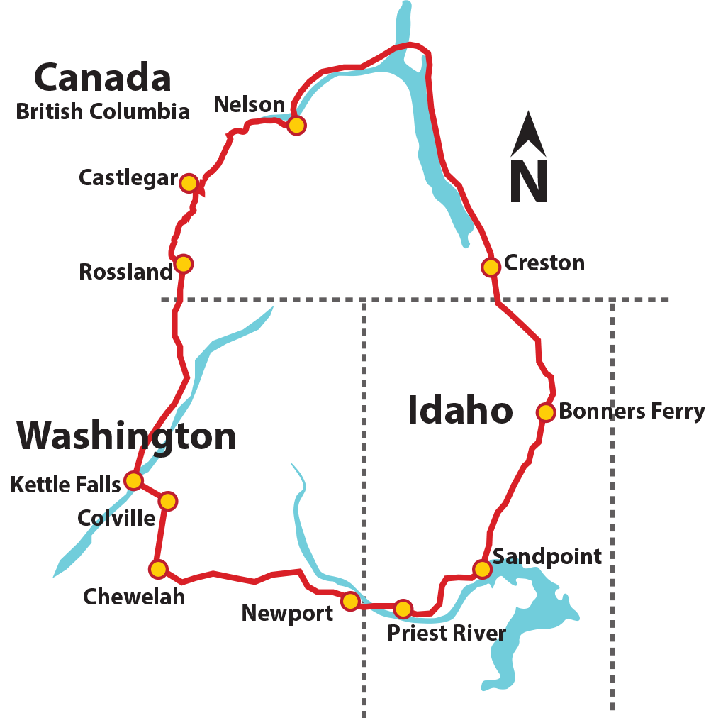
Sandpoint, ID to Colville, WA
DATE: Monday, September 9

Eagle hunting on Pend Oreille River
DISTANCE: 103 miles / 166 km
Start elev. 2,073 ft., end 1,577 ft.
MAIN FEATURES: Pend Oreille River, Flowery Trail and the Colville National Forest
PLEASE NOTE: We have significant route changes this year for day 1 to get you off of Highway and onto secondary roads. With this change, it does add a few more miles, but our amazing crew is fully prepared to shuttle anyone who needs it. Don’t let the number of miles stop you from registering!
You will start the day winding over rolling hills along the Pend Oreille River. This is a great place to watch for eagles, hawks and osprey who nest in the trees along the banks. You will pass through several small communities with small shops and business before heading west on Flowery Trail into the Colville National Forest. The Christmas Tree for the US Capitol was cut from this forest in 2013 and is a great place for hiking, mountain biking and camping, as well as the opportunity to see additional wildlife. We will then gradually climb over Flowery Trail Pass (elevation 4,046) and the home of 49 Degrees North Ski Resort. Don’t let the elevation scare you, we have the best sag support and they will be there to assist you if needed.

Bragging Rights
Once you reach the top, be sure to take advantage of the photo opportunities of the surrounding mountains and since you have earned the bragging rights – don’t forget to snap a picture of the elevation sign before heading downhill to the small community of Chewelah. The final leg of the day takes you through agricultural farms to one of Washington’s oldest cities, and where we will spend our first night – Colville.
For those riders who have completed the century, bragging rights are a must. The Colville crew will be there to award you with your WaCanId Century Club patch and your photo will be added to our album of Century Riders!